
Tunisia Geography
What is the terrain and geography like in Tunisia?
Overview
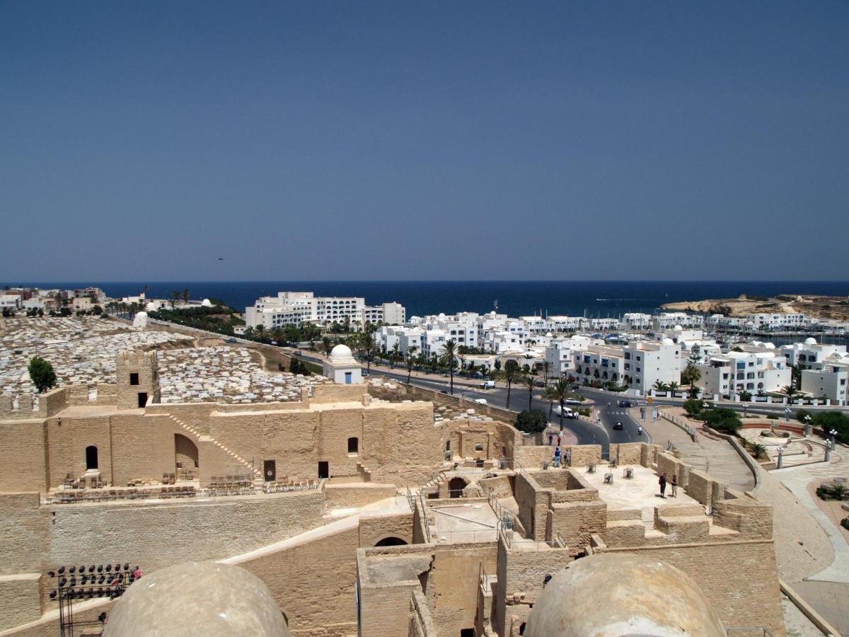
The Republic of Tunisia lies at the northernmost tip of Africa, a strategic location that throughout history has made it a crossroads between Europe and the Middle East. Tunisia, Morocco, Algeria, and northwestern Libya form the Maghreb (the West, in Arabic), an area of common history, language, ethnic groups, and culture.Tunisia has 1,000 miles of Mediterranean coastline. Northern Tunisia is the most heavily populated part of the country, mountainous (although elevations rarely reach 3,000 feet), and relatively fertile; this area was the breadbasket of the Roman Empire. The north also claims Tunisia's one major river, the Medjerda. Central Tunisia is a semi-arid highland with poor soil, little rainfall, and scant population. The south is arid and barren, except for occasional oases, as it merges with the Sahara.
Geography - note
strategic location in central Mediterranean; Malta and Tunisia are discussing the commercial exploitation of the continental shelf between their countries, particularly for oil explorationTunisia Use of Natural Resources
| Geographic Location | Africa |
| Total Area |
63,170 Square Miles 163,610 Square Kilometers |
| Land Area |
59,984 Square Miles 155,360 Square Kilometers |
| Water Area |
3,185 Square Miles 8,250 Square Kilometers |
| Land Boundaries |
885 Miles 1,424 Kilometers |
| Irrigated Land |
1,533 Square Miles 3,970 Square Kilometers |
| Border Countries | Algeria 965 km, Libya 459 km |
| Coastline |
713 Miles 1,148 Kilometers |
| Geographic Coordinates | 34 00 N, 9 00 E |
| Terrain | mountains in north; hot, dry central plain; semiarid south merges into the Sahara |
| Highest Point | 1,544 Meters |
| Highest Point Location | Jebel ech Chambi 1,544 m |
| Lowest Point | -17 Meters |
| Lowest Point Location | Shatt al Gharsah -17 m |
| Natural Resources | petroleum, phosphates, iron ore, lead, zinc, salt |
| Time Zone | UTC+1 (6 hours ahead of Washington, DC during Standard Time) |
World Regions
All Countries
Afghanistan
Akrotiri
Albania
Algeria
American Samoa
Andorra
Angola
Anguilla
Antarctica
Antigua and Barbuda
Argentina
Armenia
Aruba
Australia
Austria
Azerbaijan
Bahamas
Bahrain
Bangladesh
Barbados
Belarus
Belgium
Belize
Benin
Bermuda
Bhutan
Bolivia
Bosnia and Herzegovina
Botswana
Brazil
British Indian Ocean Territory
British Virgin Islands
Brunei
Bulgaria
Burkina Faso
Burma
Burundi
Cabo Verde
Cambodia
Cameroon
Canada
Cayman Islands
Central African Republic
Chad
Chile
China
Christmas Island
Clipperton Island
Cocos (Keeling) Islands
Colombia
Comoros
Congo, Democratic Republic of the
Congo, Republic of the
Cook Islands
Coral Sea Islands
Costa Rica
Cote d’Ivoire
Croatia
Cuba
Curacao
Cyprus
Czech Republic
Denmark
Dhekelia
Djibouti
Dominica
Dominican Republic
Ecuador
Egypt
El Salvador
Equatorial Guinea
Eritrea
Estonia
Eswatini
Ethiopia
Falkland Islands
Faroe Islands
Fiji
Finland
France
French Guiana
French Polynesia
Gabon
Gambia, The
Gaza Strip
Georgia
Germany
Ghana
Gibraltar
Greece
Greenland
Grenada
Guadeloupe
Guam
Guatemala
Guernsey
Guinea
Guinea-Bissau
Guyana
Haiti
Holy See
Honduras
Hong Kong
Hungary
Iceland
India
Indonesia
Iran
Iraq
Ireland
Isle of Man
Israel
Italy
Jamaica
Jan Mayen
Japan
Jersey
Jordan
Kazakhstan
Kenya
Kiribati
Korea, North
Korea, South
Kosovo
Kuwait
Kyrgyzstan
Laos
Latvia
Lebanon
Lesotho
Liberia
Libya
Liechtenstein
Lithuania
Luxembourg
Macau
Madagascar
Malawi
Malaysia
Maldives
Mali
Malta
Marshall Islands
Martinique
Mauritania
Mauritius
Mayotte
Mexico
Micronesia
Moldova
Monaco
Mongolia
Montenegro
Montserrat
Morocco
Mozambique
Namibia
Nauru
Nepal
Netherlands
New Caledonia
New Zealand
Nicaragua
Niger
Nigeria
Niue
Norfolk Island
North Macedonia
Northern Mariana Islands
Norway
Oman
Pakistan
Palau
Panama
Papua New Guinea
Paraguay
Peru
Philippines
Pitcairn Islands
Poland
Portugal
Puerto Rico
Qatar
Reunion
Romania
Russia
Rwanda
Saint Helena, Ascension, and Tristan da Cunha
Saint Kitts and Nevis
Saint Lucia
Saint Pierre and Miquelon
Saint Vincent and the Grenadines
Samoa
San Marino
Sao Tome and Principe
Saudi Arabia
Senegal
Serbia
Seychelles
Sierra Leone
Singapore
Slovakia
Slovenia
Solomon Islands
Somalia
South Africa
Spain
Sri Lanka
Sudan
Sudan, South
Suriname
Svalbard
Sweden
Switzerland
Syria
Taiwan
Tajikistan
Tanzania
Thailand
Timor-Leste
Togo
Tokelau
Tonga
Trinidad and Tobago
Tunisia
Turkey
Turkmenistan
Turks and Caicos Islands
Tuvalu
Uganda
Ukraine
United Arab Emirates
United Kingdom
United States (US)
Uruguay
Uzbekistan
Vanuatu
Venezuela
Vietnam
Virgin Islands
Wake Island
Wallis and Futuna
West Bank
Western Sahara
World
Yemen
Zambia
Zimbabwe