Marshall Islands Geography

What is the terrain and geography like in Marshall Islands?

Overview

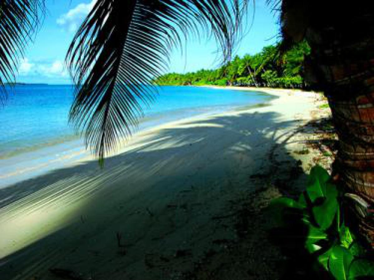
The Marshall Islands are located in the eastern part of the geographic region known as Micronesia, or *quot;Little Islands," a myriad of more than 2,100 coral atolls and volcanic islands scattered across 3 million square miles of the western Pacific Ocean.

The Marshall Islands lie between latitude 4-14°N. and longitude 160-173°E. The 29 coral atolls and 5 single islands of the Marshall Islands form two parallel groups extending northwest and southeast-the Ratak ("Sunrise") Chain and Ralik ("Sunset") chain. Total land area of all of the Marshall Islands is 70 square miles. Marine resources are abundant, but poor soil provides little opportunity for agriculture, except for the harvesting and drying of coconut meat into copra, the only revenue opportunity for outer islanders.

Each atoll is a cluster of small, low‑lying islands, none more than a few meters above sea level, circling a lagoon. The development of a coral atoll begins with coral growth around the edge of a high, often volcanic mountain. Growth continues as the mountain slowly sinks beneath the sea, leaving behind a circular reef that grows into small islands, islets, and open reef surrounding a lagoon.

Most atolls have free‑flowing water across most of the reef, with one or two openings for boats to enter the lagoon. The islands of most atolls are not contiguous, with stretches of open reef extending for miles between islands. As the distances between islands in an atoll can be many miles, travel from island to island within an atoll can be difficult.

Linking the islands of the southern side of Majuro Atoll runs the longest paved road in Micronesia, the islands having been artificially joined over the years by a 32‑mile continuous road.

Geography - note

the islands of Bikini and Enewetak are former US nuclear test sites; Kwajalein atoll, famous as a World War II battleground, surrounds the world's largest lagoon and is used as a US missile test range; the island city of Ebeye is the second largest settlement in the Marshall Islands, after the capital of Majuro, and one of the most densely populated locations in the Pacific

Climate

The climate of the Marshall Islands is tropical, with high humidity, and an average year‑round temperature of 81°F. Trade winds pick up in October or November and blow strongly from January through April, with winds varying from 12 to 22 knots. The trades, often bringing overcast skies, have a cooling effect, although the lagoon can become rough, compared to the placid days of glassy water, so frequent in summer.


Typhoon (tropical hurricane) season is from December through March. Tropical depressions form in the Marshall Islands and increase to typhoon strength as they move further west with the prevailing trade winds, making the Marshall Islands less susceptible to a full strength typhoon than most islands in the Pacific.


In Majuro, January, February, and March are traditionally the driest months, with rainfall averaging 6-8 inches a month. September through December are the wettest months, with 12-14 inches of average monthly rainfall. The temperature remains stable year-round, averaging 84°F in the day and 76°F at night.


The Marshall Islands enjoy clean air, clear ocean water, sunshine, and adequate amounts of rainfall, with the exception of the heavily populated areas of Majuro and Ebeye, where city living has taken its toll on the environment. Water shortages occur at any time when rainfall has been below normal, but in Majuro, shortages will occur most toward the end of the dry season in March. The use of water catchment devices is being promoted throughout the Marshall Islands. The outer islands rely more on a subsistence economy, occasionally experiencing food shortages due to seasonal variation.

Marshall Islands Use of Natural Resources

Marshall Islands Environment

Climate:

The climate of the Marshall Islands is tropical, with high humidity, and an average year‑round temperature of 81°F. Trade winds pick up in October or November and blow strongly from January through April, with winds varying from 12 to 22 knots. The trades, often bringing overcast skies, have a cooling effect, although the lagoon can become rough, compared to the placid days of glassy water, so frequent in summer.


Typhoon (tropical hurricane) season is from December through March. Tropical depressions form in the Marshall Islands and increase to typhoon strength as they move further west with the prevailing trade winds, making the Marshall Islands less susceptible to a full strength typhoon than most islands in the Pacific.


In Majuro, January, February, and March are traditionally the driest months, with rainfall averaging 6-8 inches a month. September through December are the wettest months, with 12-14 inches of average monthly rainfall. The temperature remains stable year-round, averaging 84°F in the day and 76°F at night.


The Marshall Islands enjoy clean air, clear ocean water, sunshine, and adequate amounts of rainfall, with the exception of the heavily populated areas of Majuro and Ebeye, where city living has taken its toll on the environment. Water shortages occur at any time when rainfall has been below normal, but in Majuro, shortages will occur most toward the end of the dry season in March. The use of water catchment devices is being promoted throughout the Marshall Islands. The outer islands rely more on a subsistence economy, occasionally experiencing food shortages due to seasonal variation.

Terrain:

low coral limestone and sand islands

Natural Resources:

coconut products, marine products, deep seabed minerals

Natural Hazards:

infrequent typhoons

Environmental Issues:

inadequate supplies of potable water; pollution of Majuro lagoon from household waste and discharges from fishing vessels

Environment - International Agreements:

party to: Biodiversity, Climate Change, Climate Change-Kyoto Protocol, Desertification, Hazardous Wastes, Law of the Sea, Ozone Layer Protection, Ship Pollution, Wetlands, Whaling

signed, but not ratified: none of the selected agreements

Marshall Islands Geography

Geographic Location Oceania
Total Area 70 Square Miles
181 Square Kilometers
Land Area 70 Square Miles
181 Square Kilometers
Coastline 230 Miles
370 Kilometers
Geographic Coordinates 9 00 N, 168 00 E
Terrain low coral limestone and sand islands
Highest Point 10 Meters
Highest Point Location unnamed location on Likiep 10 m
Lowest Point Location Pacific Ocean 0 m
Natural Resources coconut products, marine products, deep seabed minerals
Time Zone UTC+12 (17 hours ahead of Washington, DC, during Standard Time)
All Countries
Afghanistan Akrotiri Albania Algeria American Samoa Andorra Angola Anguilla Antarctica Antigua and Barbuda Argentina Armenia Aruba Australia Austria Azerbaijan Bahamas Bahrain Bangladesh Barbados Belarus Belgium Belize Benin Bermuda Bhutan Bolivia Bosnia and Herzegovina Botswana Brazil British Indian Ocean Territory British Virgin Islands Brunei Bulgaria Burkina Faso Burma Burundi Cabo Verde Cambodia Cameroon Canada Cayman Islands Central African Republic Chad Chile China Christmas Island Clipperton Island Cocos (Keeling) Islands Colombia Comoros Congo, Democratic Republic of the Congo, Republic of the Cook Islands Coral Sea Islands Costa Rica Cote d’Ivoire Croatia Cuba Curacao Cyprus Czech Republic Denmark Dhekelia Djibouti Dominica Dominican Republic Ecuador Egypt El Salvador Equatorial Guinea Eritrea Estonia Eswatini Ethiopia Falkland Islands Faroe Islands Fiji Finland France French Guiana French Polynesia Gabon Gambia, The Gaza Strip Georgia Germany Ghana Gibraltar Greece Greenland Grenada Guadeloupe Guam Guatemala Guernsey Guinea Guinea-Bissau Guyana Haiti Holy See Honduras Hong Kong Hungary Iceland India Indonesia Iran Iraq Ireland Isle of Man Israel Italy Jamaica Jan Mayen Japan Jersey Jordan Kazakhstan Kenya Kiribati Korea, North Korea, South Kosovo Kuwait Kyrgyzstan Laos Latvia Lebanon Lesotho Liberia Libya Liechtenstein Lithuania Luxembourg Macau Madagascar Malawi Malaysia Maldives Mali Malta Marshall Islands Martinique Mauritania Mauritius Mayotte Mexico Micronesia Moldova Monaco Mongolia Montenegro Montserrat Morocco Mozambique Namibia Nauru Nepal Netherlands New Caledonia New Zealand Nicaragua Niger Nigeria Niue Norfolk Island North Macedonia Northern Mariana Islands Norway Oman Pakistan Palau Panama Papua New Guinea Paraguay Peru Philippines Pitcairn Islands Poland Portugal Puerto Rico Qatar Reunion Romania Russia Rwanda Saint Helena, Ascension, and Tristan da Cunha Saint Kitts and Nevis Saint Lucia Saint Pierre and Miquelon Saint Vincent and the Grenadines Samoa San Marino Sao Tome and Principe Saudi Arabia Senegal Serbia Seychelles Sierra Leone Singapore Slovakia Slovenia Solomon Islands Somalia South Africa Spain Sri Lanka Sudan Sudan, South Suriname Svalbard Sweden Switzerland Syria Taiwan Tajikistan Tanzania Thailand Timor-Leste Togo Tokelau Tonga Trinidad and Tobago Tunisia Turkey Turkmenistan Turks and Caicos Islands Tuvalu Uganda Ukraine United Arab Emirates United Kingdom United States (US) Uruguay Uzbekistan Vanuatu Venezuela Vietnam Virgin Islands Wake Island Wallis and Futuna West Bank Western Sahara World Yemen Zambia Zimbabwe