
Romania Geography
What is the terrain and geography like in Romania?
Overview
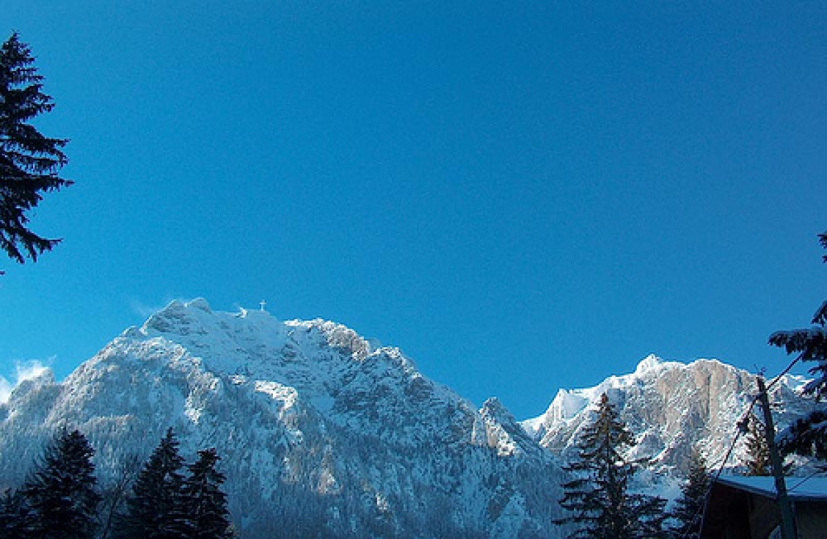
The Republic of Romania is the 12th largest country in Europe. It occupies the greater part of the lower basin of the Danube River system and the hilly eastern regions of the middle Danube Basin. Its 91,700 square miles make it similar in size to the United Kingdom and the State of Oregon. Some consider Romania to be a "Latin Island," because it is bordered by two seas: one real, the Black Sea to which Romania owes its 150 miles of coastline and the other, the sea of non-Latin countries with which it shares its other borders.The country is almost equally divided geographically into mountains, plains, hills, and plateaus. Apart from a stretch of tableland near the Black Sea coast, Romania's mountainous sector is part of the rugged Carpathian chain.
Geography - note
controls most easily traversable land route between the Balkans, Moldova, and UkraineRomania Use of Natural Resources
Romania Environment
| Climate: | Romania has a continental climate, particularly in the Old Kingdom (east and south of the Carpathians). A long, and occasionally harsh, winter (December-March), a hot summer (May-August), and a prolonged autumn (September-November) are the principal seasons. The average daily minimum temperature for Bucharest (February) is 28.6ºF, and the average daily maximum (August) is 95ºF. Rainfall, heaviest from April through July, averages 5 inches in June. |
| Terrain: | central Transylvanian Basin is separated from the Plain of Moldavia on the east by the Carpathian Mountains and separated from the Walachian Plain on the south by the Transylvanian Alps |
| Natural Resources: | petroleum (reserves declining), timber, natural gas, coal, iron ore, salt, arable land, hydropower |
| Natural Hazards: | earthquakes, most severe in south and southwest; geologic structure and climate promote landslides |
| Irrigated Land: |
2,376 Square Miles 6,153 Square Kilometers |
| Environmental Issues: | soil erosion and degradation; water pollution; air pollution in south from industrial effluents; contamination of Danube delta wetlands |
| Environment - International Agreements: | party to: Air Pollution, Air Pollution-Persistent Organic Pollutants, Antarctic-Environmental Protocol, Antarctic Treaty, Biodiversity, Climate Change, Climate Change-Kyoto Protocol, Desertification, Endangered Species, Environmental Modification, Hazardous Wastes, Law of the Sea, Ozone Layer Protection, Ship Pollution, Wetlands signed, but not ratified: none of the selected agreements |
Romania Geography
| Geographic Location | Europe |
| Total Area |
92,043 Square Miles 238,391 Square Kilometers |
| Land Area |
88,761 Square Miles 229,891 Square Kilometers |
| Water Area |
3,282 Square Miles 8,500 Square Kilometers |
| Land Boundaries |
1,558 Miles 2,508 Kilometers |
| Irrigated Land |
2,376 Square Miles 6,153 Square Kilometers |
| Border Countries | Bulgaria 608 km, Hungary 443 km, Moldova 450 km, Serbia and Montenegro 476 km, Ukraine (north) 362 km, Ukraine (east) 169 km |
| Coastline |
140 Miles 225 Kilometers |
| Geographic Coordinates | 46 00 N, 25 00 E |
| Terrain | central Transylvanian Basin is separated from the Plain of Moldavia on the east by the Carpathian Mountains and separated from the Walachian Plain on the south by the Transylvanian Alps |
| Highest Point | 2,544 Meters |
| Highest Point Location | Moldoveanu 2,544 m |
| Lowest Point Location | Black Sea 0 m |
| Natural Resources | petroleum (reserves declining), timber, natural gas, coal, iron ore, salt, arable land, hydropower |
| Time Zone | UTC+2 (7 hours ahead of Washington, DC, during Standard Time) |
| Daylight saving time | +1hr, begins last Sunday in March; ends last Sunday in October |
World Regions
All Countries
Afghanistan
Akrotiri
Albania
Algeria
American Samoa
Andorra
Angola
Anguilla
Antarctica
Antigua and Barbuda
Argentina
Armenia
Aruba
Australia
Austria
Azerbaijan
Bahamas
Bahrain
Bangladesh
Barbados
Belarus
Belgium
Belize
Benin
Bermuda
Bhutan
Bolivia
Bosnia and Herzegovina
Botswana
Brazil
British Indian Ocean Territory
British Virgin Islands
Brunei
Bulgaria
Burkina Faso
Burma
Burundi
Cabo Verde
Cambodia
Cameroon
Canada
Cayman Islands
Central African Republic
Chad
Chile
China
Christmas Island
Clipperton Island
Cocos (Keeling) Islands
Colombia
Comoros
Congo, Democratic Republic of the
Congo, Republic of the
Cook Islands
Coral Sea Islands
Costa Rica
Cote d’Ivoire
Croatia
Cuba
Curacao
Cyprus
Czech Republic
Denmark
Dhekelia
Djibouti
Dominica
Dominican Republic
Ecuador
Egypt
El Salvador
Equatorial Guinea
Eritrea
Estonia
Eswatini
Ethiopia
Falkland Islands
Faroe Islands
Fiji
Finland
France
French Guiana
French Polynesia
Gabon
Gambia, The
Gaza Strip
Georgia
Germany
Ghana
Gibraltar
Greece
Greenland
Grenada
Guadeloupe
Guam
Guatemala
Guernsey
Guinea
Guinea-Bissau
Guyana
Haiti
Holy See
Honduras
Hong Kong
Hungary
Iceland
India
Indonesia
Iran
Iraq
Ireland
Isle of Man
Israel
Italy
Jamaica
Jan Mayen
Japan
Jersey
Jordan
Kazakhstan
Kenya
Kiribati
Korea, North
Korea, South
Kosovo
Kuwait
Kyrgyzstan
Laos
Latvia
Lebanon
Lesotho
Liberia
Libya
Liechtenstein
Lithuania
Luxembourg
Macau
Madagascar
Malawi
Malaysia
Maldives
Mali
Malta
Marshall Islands
Martinique
Mauritania
Mauritius
Mayotte
Mexico
Micronesia
Moldova
Monaco
Mongolia
Montenegro
Montserrat
Morocco
Mozambique
Namibia
Nauru
Nepal
Netherlands
New Caledonia
New Zealand
Nicaragua
Niger
Nigeria
Niue
Norfolk Island
North Macedonia
Northern Mariana Islands
Norway
Oman
Pakistan
Palau
Panama
Papua New Guinea
Paraguay
Peru
Philippines
Pitcairn Islands
Poland
Portugal
Puerto Rico
Qatar
Reunion
Romania
Russia
Rwanda
Saint Helena, Ascension, and Tristan da Cunha
Saint Kitts and Nevis
Saint Lucia
Saint Pierre and Miquelon
Saint Vincent and the Grenadines
Samoa
San Marino
Sao Tome and Principe
Saudi Arabia
Senegal
Serbia
Seychelles
Sierra Leone
Singapore
Slovakia
Slovenia
Solomon Islands
Somalia
South Africa
Spain
Sri Lanka
Sudan
Sudan, South
Suriname
Svalbard
Sweden
Switzerland
Syria
Taiwan
Tajikistan
Tanzania
Thailand
Timor-Leste
Togo
Tokelau
Tonga
Trinidad and Tobago
Tunisia
Turkey
Turkmenistan
Turks and Caicos Islands
Tuvalu
Uganda
Ukraine
United Arab Emirates
United Kingdom
United States (US)
Uruguay
Uzbekistan
Vanuatu
Venezuela
Vietnam
Virgin Islands
Wake Island
Wallis and Futuna
West Bank
Western Sahara
World
Yemen
Zambia
Zimbabwe